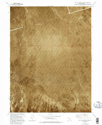
1973 Map of East of Goshute Wash
USGS Topo · Published 1995About this map
Dugway Proving Ground dominates this 1973 orthophotomap, showing a desolate stretch of the Utah desert as it functioned during the late Cold War era. This specialized topographic study uses aerial imagery to document the vast, shifting expanse of Mud Flat terrain that characterizes this portion of Tooele County. Because the landscape lacks permanent settlements or significant vegetation, the map relies on precise benchmarks like BM 4244 and BM 4243 for orientation within the military reservation. The imagery captures the subtle textures of the salt flats and desert floor, providing a raw visual record of a restricted landscape defined by its remote location and strategic isolation. This document is particularly valuable for understanding the physical state of the Great Salt Lake Desert before modern digital mapping techniques replaced traditional orthophotomosaic production.
Find a feature on this map
6 named features on this map. Tap any name to fly to it.
Don’t see what you’re looking for? This feature index may not catch every label — zoom into the map to look around manually.
Map Details
Editions of this 1973 East of Goshute Wash Map
2 editions found
Other maps of this area

1908 · Fish Springs
USGS Topo · 1:250,000

1910 · Fish Springs
USGS Topo · 1:250,000

1953 · Tooele
USGS Topo · 1:250,000

1953 · Delta
USGS Topo · 1:250,000

1955 · Tooele
USGS Topo · 1:250,000

1958 · Delta
USGS Topo · 1:250,000

1962 · Delta
USGS Topo · 1:250,000

1967 · Fish Springs NW
USGS Topo · 1:24,000
1973 · Gold Hill 4 SE
USGS Topo · 1:24,000

1973 · Granite Peak NW
USGS Topo · 1:24,000