
1973 Map of Floating Island SW
USGS Topo · Published 1977About this map
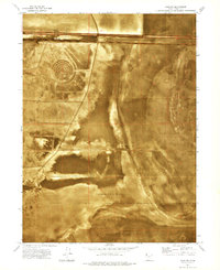
The Bonneville Salt Flats (Depression) dominates this 1970s orthophotomap, revealing the stark, crystalline geography of the Great Salt Lake Desert. This specialized survey, produced using photogrammetric methods from 1972 aerial photography, provides a high-resolution look at the specialized infrastructure of land-speed racing. The International Racetrack Overrun is clearly visible, extending into the northern sections of the salt crust. Surrounding the primary salt beds are expansive areas of Mud Flat, where the shifting boundaries between solid salt and seasonal wetness define the landscape. Beyond the racing surface, human transit is limited to a single Jeep Trail, emphasizing the area's environmental intensity. The map also documents essential surveying markers, including the Base Line and township boundaries such as the division between T 1 N and T 1 S.
Find a feature on this map
8 named features on this map. Tap any name to fly to it.
Don’t see what you’re looking for? This feature index may not catch every label — zoom into the map to look around manually.
Map Details
Editions of this 1973 Floating Island SW Map
This is the sole edition of this map. No revisions or reprints were ever made.
Other maps of this area

1953 · Tooele
USGS Topo · 1:250,000

1955 · Tooele
USGS Topo · 1:250,000

1971 · Graham Peak
USGS Topo · 1:24,000

1971 · Bonneville Racetrack
USGS Topo · 1:24,000

1973 · Arinosa
USGS Topo · 1:24,000

1973 · Arinosa NE
USGS Topo · 1:24,000

1973 · Floating Island SE
USGS Topo · 1:24,000
1973 · Salduro
USGS Topo · 1:24,000

1973 · Floating Island NE
USGS Topo · 1:24,000
1973 · Floating Island
USGS Topo · 1:24,000