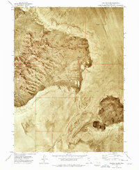
1973 Map of Floating Island
USGS Topo · Published 1977About this map
The Silver Island Mountains dominate this 1973 orthophoto survey, rising sharply from the surrounding white expanse of the Mud Flat. This specific landscape illustrates the stark geology of the Great Salt Lake Desert, where prominent peaks like Cobb Peak and the isolated mass of Floating Island appear as high-relief landmarks amidst a sea of sediment. This map captures a intersection of natural extremes and human utility, documenting scattered prospects along the mountain flanks and the southern edge of the International Racetrack Overrun. Navigating this environment at the time relied on a network of a Jeep Trail and pathways through Silver Island Canyon, reflecting the area's history of mineral exploration and high-speed automotive trials on the nearby salt flats.
Find a feature on this map
9 named features on this map. Tap any name to fly to it.
Don’t see what you’re looking for? This feature index may not catch every label — zoom into the map to look around manually.
Map Details
Editions of this 1973 Floating Island Map
2 editions found
Other maps of this area

1953 · Tooele
USGS Topo · 1:250,000

1954 · Brigham City
USGS Topo · 1:250,000

1955 · Tooele
USGS Topo · 1:250,000

1958 · Brigham City
USGS Topo · 1:250,000

1962 · Brigham City
USGS Topo · 1:250,000

1970 · Crater Island
USGS Topo · 1:24,000

1971 · Graham Peak
USGS Topo · 1:24,000

1971 · Bonneville Racetrack
USGS Topo · 1:24,000

1973 · Floating Island SW
USGS Topo · 1:24,000

1973 · Floating Island SE
USGS Topo · 1:24,000