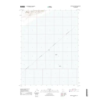
2020 Map of Bonneville Racetrack
USGS Topo · Published 2020About this map
Bonneville Racetrack dominates this expanse of the Great Salt Lake Desert, where the stark white expanse of the Bonneville Salt Flats meets the steep rising slopes of the Silver Island Mountains. The map highlights the unique land-speed infrastructure of the International Racetrack, a linear corridor crossing several sections of the public land survey system. Along the northern edge, evidence of exploration and industry appears in the form of Mine Rd and Prospect Rd, which wind through the foothills of Silver Island. The landscape is characterized by its extreme flatness and the absence of traditional hydrography, focused instead on the specialized geography of the salt crust that has made this part of Tooele County famous for automotive testing and record-breaking attempts.
Find a feature on this map
8 named features on this map. Tap any name to fly to it.
Don’t see what you’re looking for? This feature index may not catch every label — zoom into the map to look around manually.
Map Details
Editions of this 2020 Bonneville Racetrack Map
This is the sole edition of this map. No revisions or reprints were ever made.
Other maps of this area

1953 · Tooele
USGS Topo · 1:250,000

1955 · Tooele
USGS Topo · 1:250,000

1971 · Silver Island Pass
USGS Topo · 1:24,000

1971 · Graham Peak
USGS Topo · 1:24,000

1971 · Tetzlaff Peak
USGS Topo · 1:24,000

1971 · Bonneville Racetrack
USGS Topo · 1:24,000

1973 · Arinosa
USGS Topo · 1:24,000

1973 · Floating Island SW
USGS Topo · 1:24,000
1973 · Silsbee
USGS Topo · 1:24,000
1973 · Salduro
USGS Topo · 1:24,000