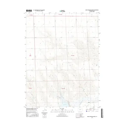
2016 Map of Bonny Reservoir North
USGS Topo · Published 2016About this map
Hale sits at the southern edge of this landscape, a small community shaped by its proximity to the S Fork Republican River. The terrain is defined by a series of drainage patterns, including the winding Sand Cr and Armknecht Cr, which cut through the high plains of Yuma County. Much of the local infrastructure supports the agricultural and water management needs of the region, evidenced by the presence of the Hale Ditch and the expansive waters of the Bonny Reservoir.
Find a feature on this map
28 named features on this map. Tap any name to fly to it.
Don’t see what you’re looking for? This feature index may not catch every label — zoom into the map to look around manually.
Map Details
Editions of this 2016 Bonny Reservoir North Map
This is the sole edition of this map. No revisions or reprints were ever made.
Other maps of this area

1950 · Bonny Reservoir
USGS Topo · 1:62,500

1954 · Limon
USGS Topo · 1:250,000

1957 · Limon
USGS Topo · 1:250,000

1958 · Limon
USGS Topo · 1:250,000

1963 · Beecher Island
USGS Topo · 1:24,000
1963 · Armel
USGS Topo · 1:24,000

1963 · Wildcat Canyon
USGS Topo · 1:24,000

1968 · Bonny Reservoir North
USGS Topo · 1:24,000

1968 · Idalia
USGS Topo · 1:24,000

1969 · Idalia SE
USGS Topo · 1:24,000