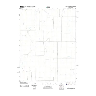
2010 Map of Bonny Reservoir SE
USGS Topo · Published 2010About this map
Little Beaver Creek and its neighboring drainages define the landscape of this Yuma County corner just east of the state line. The terrain is structured by a rigorous grid of section-line roads, such as County Road QQ and County Road KK, which overlay the natural meandering paths of Beaver Creek and Battle Creek. This alignment illustrates the classic High Plains settlement pattern where modern agriculture and transportation infrastructure adapt to intermittent waterways. While names of specific towns are absent from this immediate area, the dense network of rural routes like County Road RR 8/10 and County Road PP 5/10 suggests a landscape of active farmsteads and managed rangeland. The presence of Bonny Creek in the northwest corner points toward the nearby reservoir basin, marking an important hydrological junction for the regional watershed in the early 21st century.
Find a feature on this map
26 named features on this map. Tap any name to fly to it.
Don’t see what you’re looking for? This feature index may not catch every label — zoom into the map to look around manually.
Map Details
Editions of this 2010 Bonny Reservoir SE Map
This is the sole edition of this map. No revisions or reprints were ever made.
Other maps of this area

1950 · Bonny Reservoir
USGS Topo · 1:62,500

1952 · St Francis 3
USGS Topo · 1:62,500

1954 · Limon
USGS Topo · 1:250,000

1954 · Goodland
USGS Topo · 1:250,000

1956 · Goodland
USGS Topo · 1:250,000

1957 · Limon
USGS Topo · 1:250,000

1957 · Goodland
USGS Topo · 1:250,000

1958 · Limon
USGS Topo · 1:250,000

1966 · Ruleton NW
USGS Topo · 1:24,000

1968 · Bonny Reservoir North
USGS Topo · 1:24,000