
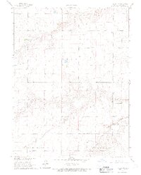
1966 Map of Ruleton NW
USGS Topo · Published 1967About this map
Middle Fork Beaver Creek winds across this section of the High Plains, carving a distinct drainage pattern through the townships of Grant and Lincoln. The landscape in the mid-1960s was defined by sparse industrial markers and the rigid geometries of section lines, including the prominent State Line marking the western boundary of the county. In a region where water sources and topographic shifts are critical to land use, the map reveals the relationship between the natural creek beds and early local industry, notably at several Sandpit sites located along the valley floor. The scattered presence of numerous wells indicates the importance of groundwater for agriculture and settlement in this portion of Sherman County.
Find a feature on this map
6 named features on this map. Tap any name to fly to it.
Don’t see what you’re looking for? This feature index may not catch every label — zoom into the map to look around manually.
Map Details
Editions of this 1966 Ruleton NW Map
2 editions found
Other maps of this area

1950 · Bonny Reservoir
USGS Topo · 1:62,500

1952 · St Francis 3
USGS Topo · 1:62,500

1954 · Limon
USGS Topo · 1:250,000

1954 · Goodland
USGS Topo · 1:250,000

1956 · Goodland
USGS Topo · 1:250,000

1957 · Limon
USGS Topo · 1:250,000

1957 · Goodland
USGS Topo · 1:250,000

1958 · Limon
USGS Topo · 1:250,000

1966 · Ruleton NE
USGS Topo · 1:24,000

1966 · Ruleton
USGS Topo · 1:24,000