
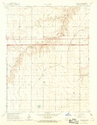
1966 Map of Ruleton NE
USGS Topo · Published 1967About this map
Middle Fork Beaver Creek and its southern counterpart, the South Fork Beaver Creek, carve a distinct drainage pattern through this portion of Sherman County. This mid-1960s survey documents a landscape defined by the intersection of four townships—Grant, Voltaire, Lincoln, and Logan—highlighting a rural agricultural character where water management and extraction were paramount.
Find a feature on this map
12 named features on this map. Tap any name to fly to it.
Don’t see what you’re looking for? This feature index may not catch every label — zoom into the map to look around manually.
Map Details
Editions of this 1966 Ruleton NE Map
This is the sole edition of this map. No revisions or reprints were ever made.
Other maps of this area

1951 · Bird City South
USGS Topo · 1:62,500

1952 · St Francis 3
USGS Topo · 1:62,500

1954 · Goodland
USGS Topo · 1:250,000

1956 · Goodland
USGS Topo · 1:250,000

1957 · Goodland
USGS Topo · 1:250,000

1966 · Goodland NW
USGS Topo · 1:24,000

1966 · Goodland
USGS Topo · 1:24,000

1966 · Ruleton NW
USGS Topo · 1:24,000

1966 · Ruleton
USGS Topo · 1:24,000
1966 · Ruleton SE
USGS Topo · 1:24,000