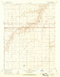
1966 Map of Ruleton SE
USGS Topo · Published 1967About this map
Caruso stands as the primary settlement node along the northern edge of this high-plains landscape, situated beside the Chicago Rock Island and Pacific railroad. The mid-1960s was a period of significant infrastructure transformation for this part of Sherman Co., as evidenced by the heavy line of Interstate 70 shown Under Construction across the center of the sheet. This new thoroughfare cuts across traditional drainage patterns, including the winding paths of South Fork Sappa Creek and Middle Fork Sappa Creek. The terrain is deeply incised by these watercourses and Beaver Creek, creating a series of breaks and draws that define the local geography. Notable landmarks of the era include several sandpits used for construction and a prominent Radio Tower (KLOE) near the eastern boundary.
Find a feature on this map
17 named features on this map. Tap any name to fly to it.
Don’t see what you’re looking for? This feature index may not catch every label — zoom into the map to look around manually.
Map Details
Editions of this 1966 Ruleton SE Map
2 editions found
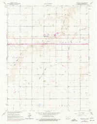
Other maps of this area

1954 · Goodland
USGS Topo · 1:250,000

1956 · Goodland
USGS Topo · 1:250,000

1957 · Goodland
USGS Topo · 1:250,000

1959 · Harris Draw
USGS Topo · 1:62,500

1959 · Horsethief Draw
USGS Topo · 1:62,500

1966 · Goodland NW
USGS Topo · 1:24,000

1966 · Goodland
USGS Topo · 1:24,000

1966 · Ruleton NW
USGS Topo · 1:24,000

1966 · Ruleton NE
USGS Topo · 1:24,000

1966 · Ruleton
USGS Topo · 1:24,000