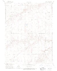
1966 Map of Ruleton NW
USGS Topo · Published 1967About this map
The rolling grasslands of Sherman County are defined here by the winding course of the Middle Fork Beaver Creek, which carves its way through the landscape as it crosses between Grant and Lincoln townships. This 1966 field survey captures a moment of sparse agricultural settlement on the High Plains, where the terrain is marked more by natural drainage patterns and section lines than by dense development. Small-scale industrial activity is evident near the creek bed, where a Sandpit indicates local resource extraction. The map also delineates the State Line, illustrating the precise boundary where the Kansas plains meet the neighboring territory, providing a clear record of land division and rural topography in the mid-1960s.
Find a feature on this map
5 named features on this map. Tap any name to fly to it.
Don’t see what you’re looking for? This feature index may not catch every label — zoom into the map to look around manually.
Map Details
Editions of this 1966 Ruleton NW Map
2 editions found
Other maps of this area

1950 · Bonny Reservoir
USGS Topo · 1:62,500

1952 · St Francis 3
USGS Topo · 1:62,500

1954 · Limon
USGS Topo · 1:250,000

1954 · Goodland
USGS Topo · 1:250,000

1956 · Goodland
USGS Topo · 1:250,000

1957 · Limon
USGS Topo · 1:250,000

1957 · Goodland
USGS Topo · 1:250,000

1958 · Limon
USGS Topo · 1:250,000

1966 · Ruleton NW
USGS Topo · 1:24,000

1966 · Ruleton NE
USGS Topo · 1:24,000