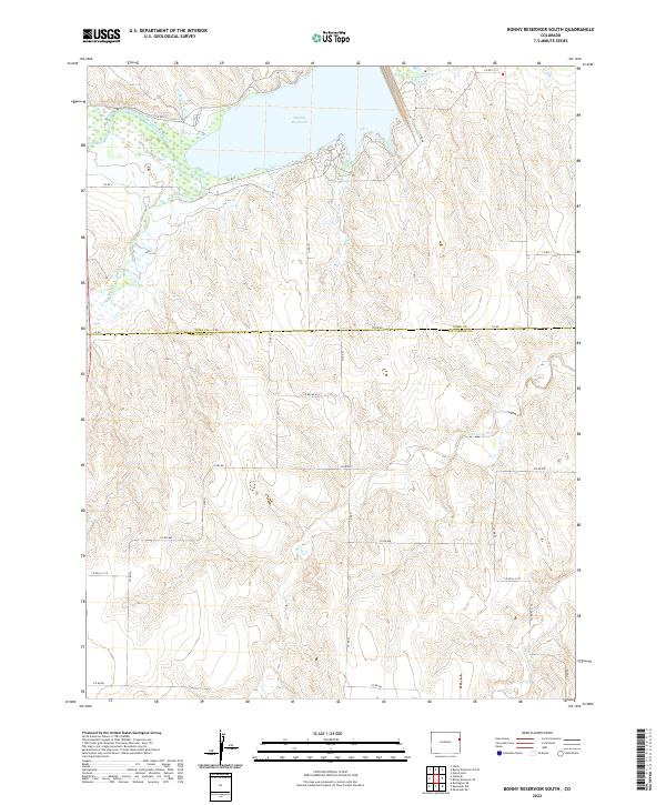
2022 Map of Bonny Reservoir South
USGS Topo · Published 2022About this map
The Bonny Reservoir and its surrounding drainage basin define this portion of the High Plains along the border of Yuma and Kit Carson counties. Fed by the South Fork Republican River, the reservoir is a central hydrologic feature supported by a complex network of smaller tributaries including Landsman Cr, Armknecht Cr, and Bonny Creek. The presence of the Hale Ditch Aqueduct and Hale Ditch in the northern sections illustrates the critical role of water management and irrigation in this semi-arid landscape. Historically, the area is dominated by the Public Land Survey System grid, which dictates the placement of rural roads like Co RD RR and Co RD 53. The terrain is characterized by the erosional patterns of ephemeral streams like Beaver Cr, which carve through the plains toward the Republican River valley.
Find a feature on this map
35 named features on this map. Tap any name to fly to it.
Don’t see what you’re looking for? This feature index may not catch every label — zoom into the map to look around manually.
Map Details
Editions of this 2022 Bonny Reservoir South Map
This is the sole edition of this map. No revisions or reprints were ever made.
Other maps of this area

1950 · Bonny Reservoir
USGS Topo · 1:62,500

1954 · Limon
USGS Topo · 1:250,000

1957 · Limon
USGS Topo · 1:250,000

1958 · Limon
USGS Topo · 1:250,000

1968 · Bonny Reservoir North
USGS Topo · 1:24,000

1968 · Idalia
USGS Topo · 1:24,000

1969 · Kanorado NE
USGS Topo · 1:24,000

1969 · Idalia SE
USGS Topo · 1:24,000

1969 · Kanorado NW
USGS Topo · 1:24,000
1969 · Burlington NE
USGS Topo · 1:24,000