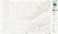
1983 Map of Bonny Reservoir
USGS Topo · Published 1984About this map
Bonny Reservoir and its surrounding plains dominate this 1983 survey of eastern Colorado and western Kansas. The landscape is defined by the convergence of several major waterways, including the Arikaree River and the Republican River, which feed into the reservoir and its massive Bonny Dam. Local history is anchored at sites like Beecher Island, located in the river bottom north of Armel.
Find a feature on this map
45 named features on this map. Tap any name to fly to it.
Don’t see what you’re looking for? This feature index may not catch every label — zoom into the map to look around manually.
Map Details
Editions of this 1983 Bonny Reservoir Map
This is the sole edition of this map. No revisions or reprints were ever made.
Other maps of this area

1942 · St. Francis
USGS Topo · 1:62,500

1943 · St. Francis
USGS Topo · 1:62,500

1950 · Bonny Reservoir
USGS Topo · 1:62,500

1951 · St Francis
USGS Topo · 1:62,500

1952 · St Francis 3
USGS Topo · 1:62,500

1954 · Limon
USGS Topo · 1:250,000

1954 · Sterling
USGS Topo · 1:250,000

1954 · McCook
USGS Topo · 1:250,000

1954 · Goodland
USGS Topo · 1:250,000

1956 · Goodland
USGS Topo · 1:250,000