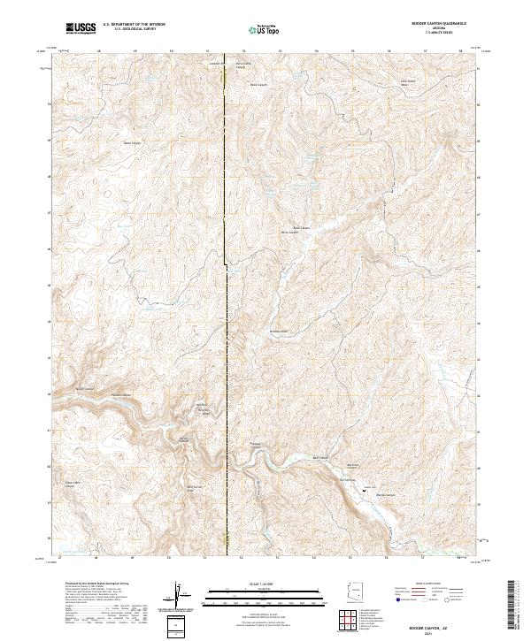
2021 Map of Booger Canyon
USGS Topo · Published 2021About this map
Aravaipa Cr carves through the center of this landscape, anchoring a complex system of drainage and relief along the border of Graham and Pinal counties. This arid territory is defined by its water management and natural catchments, featuring Numerous tanks such as Big Tank, Double Tank, and Woodrow Tank that supported cattle or local utility in a region of extreme verticality. The Aravaipa Canyon area is flanked by notable landmarks like The Chimney and Lookout Mtn, while the southern reaches show evidence of early settlement infrastructure with the Aravaipa Town Rd and the Salazar Cem. The map reveals a transition from the high ground of Lone Cedar Mesa to the intricate network of gulches and draws, including Arizona Gulch and Wire Corral Draw, which illustrate the difficult navigation of the Hell Hole Valley corridor.
Find a feature on this map
45 named features on this map. Tap any name to fly to it.
Don’t see what you’re looking for? This feature index may not catch every label — zoom into the map to look around manually.
Map Details
Editions of this 2021 Booger Canyon Map
This is the sole edition of this map. No revisions or reprints were ever made.
Other maps of this area

1911 · Winkelman
USGS Topo · 1:125,000

1913 · Winkelman
USGS Topo · 1:125,000

1915 · Christmas
USGS Topo · 1:62,500

1917 · Christmas
USGS Topo · 1:62,500

1938 · Klondyke
USGS Topo · 1:48,000

1943 · Klondyke
USGS Topo · 1:62,500

1949 · Holy Joe Peak
USGS Topo · 1:62,500

1949 · Brandenburg Mtn
USGS Topo · 1:24,000
1949 · Holy Joe Peak
USGS Topo · 1:24,000
1950 · Brandenburg Mtn
USGS Topo · 1:24,000