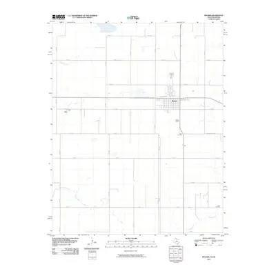
2010 Map of Booker
USGS Topo · Published 2010About this map
Booker serves as the focal point of this northern Panhandle landscape, where the grid-based settlement of Lipscomb County meets the open ranch and farmland of the Texas-Oklahoma border. The town is oriented around the former rail corridor, now reflected in local street names like W Santa Fe Ln. Evidence of the area's agricultural and civil development is scattered across the township and its outskirts, from the Booker Airport to the historic Old Darrouzett Hwy. Outside of the primary settlement, the terrain is defined by the winding paths of Duck Pond Creek in the north and Kiowa Creek in the south. These watercourses provide a natural counterpoint to the rigid network of county roads. Genealogists will find interest in the documented locations of Heart Cemetery and Kiowa Cemetery, which sit as enduring markers of the early families who settled this high plains region.
Find a feature on this map
25 named features on this map. Tap any name to fly to it.
Don’t see what you’re looking for? This feature index may not catch every label — zoom into the map to look around manually.
Map Details
Editions of this 2010 Booker Map
This is the sole edition of this map. No revisions or reprints were ever made.
Other maps of this area

1954 · Perryton
USGS Topo · 1:250,000

1958 · Perryton
USGS Topo · 1:250,000

1971 · Clear Lake SW
USGS Topo · 1:24,000

1972 · Gaylord
USGS Topo · 1:24,000

1972 · Twin Grove
USGS Topo · 1:24,000

1972 · Booker SE
USGS Topo · 1:24,000

1973 · Booker
USGS Topo · 1:24,000

1973 · Booker SW
USGS Topo · 1:24,000

1973 · Elmwood
USGS Topo · 1:24,000

1973 · Balko SW
USGS Topo · 1:24,000