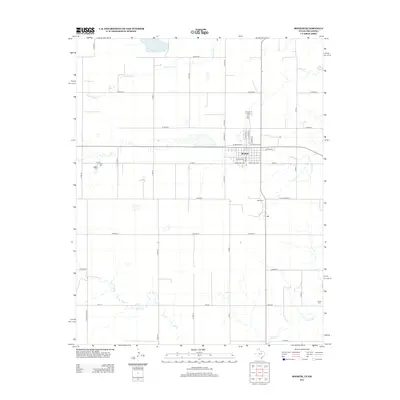
2012 Map of Booker
USGS Topo · Published 2012About this map
Booker centers this 2012 survey, revealing the grid of a High Plains community at the intersection of local history and agricultural transit. The town's layout is defined by streets like N Main St, S Main St, and Kiowa St, with the legacy of rail transport clearly visible in the naming of W Santa Fe Ln and E Santa Fe Ln. The surrounding landscape of Lipscomb County is a patchwork of section roads, including Co Road G and Co Road H, which navigate the drainages of Duck Pond Cr to the north and Kiowa Cr to the south.
Find a feature on this map
34 named features on this map. Tap any name to fly to it.
Don’t see what you’re looking for? This feature index may not catch every label — zoom into the map to look around manually.
Map Details
Editions of this 2012 Booker Map
This is the sole edition of this map. No revisions or reprints were ever made.
Other maps of this area

1954 · Perryton
USGS Topo · 1:250,000

1958 · Perryton
USGS Topo · 1:250,000

1971 · Clear Lake SW
USGS Topo · 1:24,000

1972 · Gaylord
USGS Topo · 1:24,000

1972 · Twin Grove
USGS Topo · 1:24,000

1972 · Booker SE
USGS Topo · 1:24,000

1973 · Booker
USGS Topo · 1:24,000

1973 · Booker SW
USGS Topo · 1:24,000

1973 · Elmwood
USGS Topo · 1:24,000

1973 · Balko SW
USGS Topo · 1:24,000