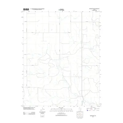
2012 Map of Booker SE
USGS Topo · Published 2012About this map
Gilhula Cr and its many winding tributaries define the hydrology of this corner of the Texas Panhandle, creating a dendritic pattern across the landscape of Lipscomb County. In the early 21st century, this area remains characterized by a disciplined grid of rural infrastructure, where thoroughfares like Ranch Road 2711 and Co Road K segment the terrain into large agricultural or ranching tracts. The map reveals the persistence of local nomenclature for even the smallest routes, such as the uniquely named Uncle Sam and Peety roads. Further north, the drainage of Kiowa Cr and First Cr provides topographical variation to an otherwise strictly surveyed prairie. This 2012 survey illustrates a modern ranching landscape where natural watercourses and man-made boundaries coexist in a sparsely populated but highly organized territory.
Find a feature on this map
14 named features on this map. Tap any name to fly to it.
Don’t see what you’re looking for? This feature index may not catch every label — zoom into the map to look around manually.
Map Details
Editions of this 2012 Booker SE Map
This is the sole edition of this map. No revisions or reprints were ever made.
Other maps of this area

1954 · Perryton
USGS Topo · 1:250,000

1958 · Perryton
USGS Topo · 1:250,000

1972 · Barton Corners
USGS Topo · 1:24,000

1972 · Gaylord
USGS Topo · 1:24,000

1972 · Twin Grove
USGS Topo · 1:24,000

1972 · Booker SE
USGS Topo · 1:24,000

1973 · Booker
USGS Topo · 1:24,000

1973 · Booker SW
USGS Topo · 1:24,000

1973 · Lake Fryer
USGS Topo · 1:24,000
1973 · Lake Fryer NE
USGS Topo · 1:24,000