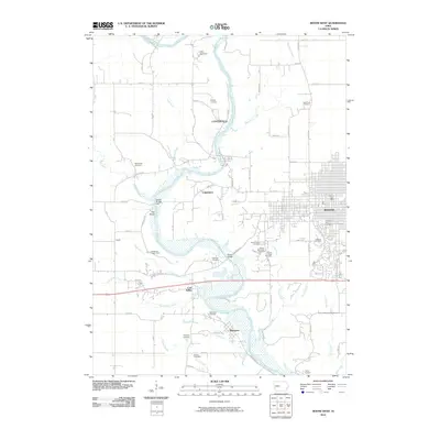
2010 Map of Boone West
USGS Topo · Published 2010About this map
The Des Moines River winds through the heart of this landscape, carving a wide valley that historically dictated the placement of small river settlements and early transport routes. On the eastern edge, the city of Boone presents a structured grid of residential streets and civil infrastructure, including the Boone Post Office and Linwood Park Cemetery. Further west, the terrain becomes more varied as numerous tributaries like Coal Valley Creek and Honey Creek feed into the main river channel. Smaller, discrete settlements such as Centerville, Moingona, and Coal Valley are scattered along these waterways, reflecting a legacy of coal mining and river-borne commerce. The map is notable for its high density of rural burial grounds, including the Buckley Cemetery and Rose Hill Cemetery, which offer valuable locations for genealogical research and local history documentation.
Find a feature on this map
75 named features on this map. Tap any name to fly to it.
Don’t see what you’re looking for? This feature index may not catch every label — zoom into the map to look around manually.
Map Details
Editions of this 2010 Boone West Map
This is the sole edition of this map. No revisions or reprints were ever made.
Other maps of this area

1911 · Madrid
USGS Topo · 1:62,500

1914 · Madrid
USGS Topo · 1:62,500

1916 · Boone
USGS Topo · 1:62,500

1950 · Perry
USGS Topo · 1:62,500

1951 · Perry
USGS Topo · 1:62,500

1951 · Ogden
USGS Topo · 1:62,500

1954 · Omaha
USGS Topo · 1:250,000

1954 · Waterloo
USGS Topo · 1:250,000

1954 · Fort Dodge
USGS Topo · 1:250,000

1954 · Des Moines
USGS Topo · 1:250,000