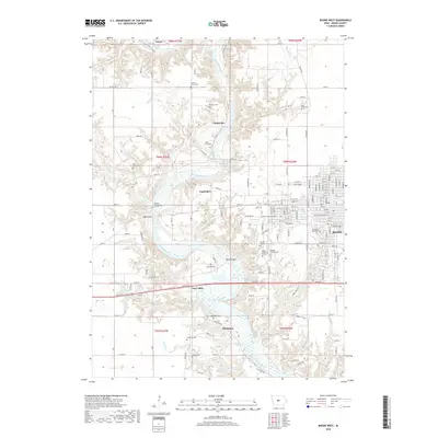
2018 Map of Boone West
USGS Topo · Published 2018About this map
The Des Moines River winds through this central Iowa landscape, carving a deep valley that defines the area's geography and history. The western edge of Boone transitions into a series of smaller settlements and coal-era remnants like Coal Valley and Moingona. Transportation is a central theme, evidenced by the massive Boone Bridge Two and Boone Bridge that span the river valley, connecting the high plateaus. Genealogists will find a dense concentration of burial sites, including the isolated Milton Lott Grave north of Logansport, alongside larger grounds like Linwood Park Cem and Rose Hill Cem. The terrain breaks away from the flat farmland into the Noble Hills and numerous side-creeks such as Bluff Creek and Honey Creek, illustrating the dramatic shift in elevation where the river has cut through the glacial till.
Find a feature on this map
108 named features on this map. Tap any name to fly to it.
Don’t see what you’re looking for? This feature index may not catch every label — zoom into the map to look around manually.
Map Details
Editions of this 2018 Boone West Map
This is the sole edition of this map. No revisions or reprints were ever made.
Other maps of this area

1911 · Madrid
USGS Topo · 1:62,500

1914 · Madrid
USGS Topo · 1:62,500

1916 · Boone
USGS Topo · 1:62,500

1950 · Perry
USGS Topo · 1:62,500

1951 · Perry
USGS Topo · 1:62,500

1951 · Ogden
USGS Topo · 1:62,500

1954 · Omaha
USGS Topo · 1:250,000

1954 · Waterloo
USGS Topo · 1:250,000

1954 · Fort Dodge
USGS Topo · 1:250,000

1954 · Des Moines
USGS Topo · 1:250,000