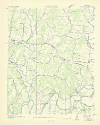
1936 Map of Boonshill
USGS Topo · Published 1936About this map
Boonshill and its neighboring rural communities are captured here during a period of infrastructure expansion in mid-1930s Middle Tennessee. The landscape is defined by the winding course of the Elk River, which carves deep loops at Hovey Bend and Pitts Bend in the southern portion of the quadrangle. A significant focus of this survey is the emerging utility network, evidenced by the prominent Electric Membership Corp Line and the TEP Co Power Plant near Harms.
Find a feature on this map
51 named features on this map. Tap any name to fly to it.
Don’t see what you’re looking for? This feature index may not catch every label — zoom into the map to look around manually.
Map Details
Editions of this 1936 Boonshill Map
2 editions found
Other maps of this area

1936 · Cornersville
USGS Topo · 1:24,000

1936 · Taft
USGS Topo · 1:24,000

1936 · Belleville
USGS Topo · 1:24,000

1936 · Boonshill
USGS Topo · 1:24,000

1936 · Petersburg
USGS Topo · 1:24,000

1936 · Lincoln
USGS Topo · 1:24,000

1936 · Frankewing
USGS Topo · 1:24,000

1936 · Fayetteville
USGS Topo · 1:24,000

1936 · Dellrose
USGS Topo · 1:24,000

1944 · Shelbyville
USGS Topo · 1:100,000