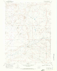
1968 Map of Boot Heel
USGS Topo · Published 1972About this map
Arrowhead Ranch sits at the center of this high-plains landscape, situated near the distinctive Boot Heel landform. This 1968 survey reveals a terrain defined by sparse ranching operations and essential water management features like Priel Reservoir and Johnson Flat Reservoir. The geography is shaped by significant drainage systems and ridgelines, notably Sheep Creek and the starkly named Carcass Ridge.
Find a feature on this map
16 named features on this map. Tap any name to fly to it.
Don’t see what you’re looking for? This feature index may not catch every label — zoom into the map to look around manually.
Map Details
Editions of this 1968 Boot Heel Map
This is the sole edition of this map. No revisions or reprints were ever made.
Other maps of this area

1954 · Torrington
USGS Topo · 1:250,000

1955 · Casper
USGS Topo · 1:250,000

1958 · Casper
USGS Topo · 1:250,000

1958 · Torrington
USGS Topo · 1:250,000

1959 · Chalk Hills
USGS Topo · 1:24,000
1961 · Walker Draw SE
USGS Topo · 1:24,000
1961 · Big Charlie Lakes
USGS Topo · 1:24,000

1962 · Casper
USGS Topo · 1:250,000
1964 · Pass Creek
USGS Topo · 1:24,000

1964 · Marshall
USGS Topo · 1:24,000