
1964 Map of Marshall
USGS Topo · Published 1968About this map
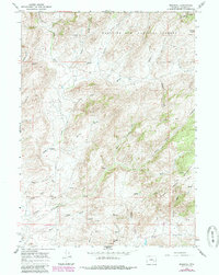
Marshall and the Bennett Place occupy a high-elevation landscape within the Medicine Bow National Forest during the mid-1960s. The settlement pattern is defined by isolated ranching outposts and high-country landmarks like Crystal Hill and Whistler. Transport across the drainage basins of Cottonwood Creek and Mule Creek is largely facilitated by the historic Old Fort Fetterman Road and various jeep tracks, such as the Mule Creek Trail. The map reveals a legacy of resource exploration with several marked prospects and a gravel pit near the Mine Hills. Water is a critical feature of this terrain, with numerous named draws and springs—including Old Maids Draw and Frenchy Draw—feeding into the larger systems of Sheep Creek and Bean Creek.
Find a feature on this map
82 named features on this map. Tap any name to fly to it.
Don’t see what you’re looking for? This feature index may not catch every label — zoom into the map to look around manually.
Map Details
Editions of this 1964 Marshall Map
2 editions found
Other maps of this area

1954 · Torrington
USGS Topo · 1:250,000

1958 · Torrington
USGS Topo · 1:250,000

1964 · Toltec
USGS Topo · 1:24,000

1964 · School Section Mountain
USGS Topo · 1:24,000
1964 · Rock Creek
USGS Topo · 1:24,000
1964 · Pass Creek
USGS Topo · 1:24,000
1964 · Warbonnet Peak
USGS Topo · 1:24,000

1968 · Cottonwood Creek
USGS Topo · 1:24,000
1968 · Boot Heel
USGS Topo · 1:24,000
1968 · Rogers Creek
USGS Topo · 1:24,000