
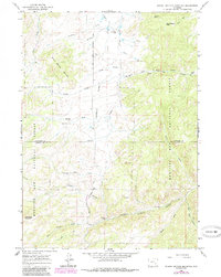
1964 Map of School Section Mountain
USGS Topo · Published 1967About this map
The Old Fort Fetterman Road carves through the central high country of this mid-1960s survey, marking a historic transportation corridor across the Wyoming landscape. This rugged interior of the Medicine Bow National Forest is defined by a ranching and mining economy, where established sites like Sims Ranch, Comb Ranch, and the Arnold Place are scattered among the drainages of Wagon Hound Creek and La Bonte Creek. The topography rises toward School Section Mountain and Camel Back Mountain, while lower-elevation features such as Downey Park Road provide access to the Pyramid Mine and various seasonal camps like Hore Cow Camp. This map provides an exceptionally detailed record of the early infrastructure of the Converse and Albany county line, preserving the locations of remote homesteads, ditches, and old jeep trails used by generations of ranchers and prospectors.
Find a feature on this map
33 named features on this map. Tap any name to fly to it.
Don’t see what you’re looking for? This feature index may not catch every label — zoom into the map to look around manually.
Map Details
Editions of this 1964 School Section Mountain Map
2 editions found
Other maps of this area

1954 · Torrington
USGS Topo · 1:250,000

1958 · Torrington
USGS Topo · 1:250,000

1964 · Toltec
USGS Topo · 1:24,000

1964 · Buffalo Peak
USGS Topo · 1:24,000
1964 · Maneater Creek
USGS Topo · 1:24,000
1964 · Blue Nose Creek
USGS Topo · 1:24,000

1964 · Saddleback Mountain
USGS Topo · 1:24,000

1964 · Windy Peak
USGS Topo · 1:24,000

1964 · Marshall
USGS Topo · 1:24,000
1964 · Warbonnet Peak
USGS Topo · 1:24,000