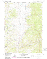
1964 Map of School Section Mountain
USGS Topo · Published 1985About this map
The Old Fort Fetterman Road bisects this Wyoming landscape, following the high ground of Downey Park between the drainage of Reed Creek and Jackson Creek. The map documents a rugged ranching and mining environment in the mid-1960s, punctuated by family-named landmarks such as Sims Ranch, Comb Ranch, and the Arnold Place near the eastern edge. The southern portion is dominated by the steep topography of the Medicine Bow National Forest, where the Pyramid Mine is located near the headwaters of La Bonte Creek. Strategic mountain crossings like Latham Pass and Chamberlain Pass provide access through the eastern ridges. Notable terrain features such as School Section Mountain and Camelback Mountain define the local relief, while the Hildebrand Ditch indicates early water management efforts to support the remote outposts and cow camps like Horr Cow Camp situated along the creek bottoms.
Find a feature on this map
33 named features on this map. Tap any name to fly to it.
Don’t see what you’re looking for? This feature index may not catch every label — zoom into the map to look around manually.
Map Details
Editions of this 1964 School Section Mountain Map
2 editions found
Other maps of this area

1954 · Torrington
USGS Topo · 1:250,000

1958 · Torrington
USGS Topo · 1:250,000

1964 · Toltec
USGS Topo · 1:24,000

1964 · School Section Mountain
USGS Topo · 1:24,000

1964 · Buffalo Peak
USGS Topo · 1:24,000
1964 · Maneater Creek
USGS Topo · 1:24,000
1964 · Blue Nose Creek
USGS Topo · 1:24,000

1964 · Saddleback Mountain
USGS Topo · 1:24,000

1964 · Windy Peak
USGS Topo · 1:24,000

1964 · Marshall
USGS Topo · 1:24,000