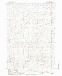
1984 Map of Bill
USGS Topo · Published 1984About this map
Bill stands as the primary settlement hub in this part of Wyoming, situated along a north-south transportation corridor marked by route 59. The surrounding landscape is defined by an intricate network of drainage patterns, where intermittent watercourses like Shelden Draw and Dry Draw shape the terrain. These ephemeral streams, along with Dry Creek and Poison Creek, reflect the arid ranching environment of the high plains, where water management is critical for local operations. Evidence of such stewardship is seen in features like Rice Reservoir in the southwestern portion of the sheet. The map captures a moment in the mid-1980s when the region's character remained centered on these isolated outposts and the vast network of seasonal draws such as Mikes Draw and Reeves Draw.
Find a feature on this map
9 named features on this map. Tap any name to fly to it.
Don’t see what you’re looking for? This feature index may not catch every label — zoom into the map to look around manually.
Map Details
Editions of this 1984 Bill Map
This is the sole edition of this map. No revisions or reprints were ever made.
Other maps of this area

1955 · Newcastle
USGS Topo · 1:250,000

1958 · Newcastle
USGS Topo · 1:250,000

1959 · Bill
USGS Topo · 1:62,500

1959 · Betty Reservoir
USGS Topo · 1:62,500

1970 · Bill 4 NW
USGS Topo · 1:24,000
1970 · Bill 4 SW
USGS Topo · 1:24,000

1971 · Tin Can Lake
USGS Topo · 1:24,000

1979 · Bill
USGS Topo · 1:100,000
1984 · Bobby Draw
USGS Topo · 1:24,000
1984 · Patsy Draw
USGS Topo · 1:24,000