
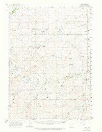
1959 Map of Bill
USGS Topo · Published 1961About this map
Ranching life in the high plains of Converse County defines this landscape, where family operations are connected by the Tillard Road and Highland Loop Road. The small community of Bill sits near the northern edge, supported by the Dry Creek Sch and the Dry Landing Strip. Water management is central to survival in this arid environment, evidenced by numerous man-made features like Government Dam, Madsen Reservoir, and Fiddleback Reservoir. These catchments, along with named wells and springs like Red Rock Spring, provided the necessary water for livestock across the Highland Flats. The map documents established holdings such as the Tillard Ranch and Johnson Ranch, while also noting the Ballard Ranch (Aband), reflecting the shifting fortunes of mid-century homesteading in Wyoming.
Find a feature on this map
50 named features on this map. Tap any name to fly to it.
Don’t see what you’re looking for? This feature index may not catch every label — zoom into the map to look around manually.
Map Details
Editions of this 1959 Bill Map
2 editions found
Other maps of this area

1949 · Sundquist Ranch
USGS Topo · 1:24,000

1949 · Gilbert Lake
USGS Topo · 1:24,000

1949 · Clausen Ranch
USGS Topo · 1:24,000

1950 · Clausen Ranch
USGS Topo · 1:24,000

1950 · Gilbert Lake
USGS Topo · 1:24,000
1950 · Sundquist Ranch
USGS Topo · 1:24,000

1954 · Torrington
USGS Topo · 1:250,000

1955 · Newcastle
USGS Topo · 1:250,000

1958 · Torrington
USGS Topo · 1:250,000

1958 · Newcastle
USGS Topo · 1:250,000