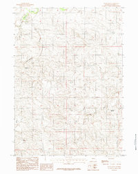
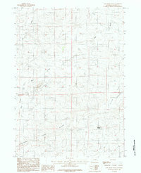
1984 Map of Patsy Draw
USGS Topo · Published 1984About this map
Cheyenne River and its tributary, the Dry Fork, define the northern drainage of this Converse County landscape during the late 1970s and early 1980s. This transitional terrain is characterized by an intricate network of ephemeral watercourses including Cottonwood Draw, Poison Draw, and Skunk Creek, which together illustrate the hydrologic patterns of the High Plains. The map highlights human modification of the arid environment through the placement of Madsen Reservoir and Anderson Reservoir, critical water storage points for ranching operations. The prominence of Patsy Draw and Dry Draw further emphasizes the seasonal nature of the local geography. As a provisional edition, this survey documents the exact drainage patterns and unimproved roads that supported local land use before more modern developments, serving as a precise record for land management and genealogical research in this sparsely settled region.
Find a feature on this map
10 named features on this map. Tap any name to fly to it.
Don’t see what you’re looking for? This feature index may not catch every label — zoom into the map to look around manually.
Map Details
Editions of this 1984 Patsy Draw Map
This is the sole edition of this map. No revisions or reprints were ever made.
Other maps of this area

1955 · Newcastle
USGS Topo · 1:250,000

1958 · Newcastle
USGS Topo · 1:250,000

1959 · Bill
USGS Topo · 1:62,500

1959 · Betty Reservoir
USGS Topo · 1:62,500

1959 · Coal Draw
USGS Topo · 1:62,500
1959 · Highland Flats
USGS Topo · 1:62,500

1979 · Bill
USGS Topo · 1:100,000
1984 · Bobby Draw
USGS Topo · 1:24,000
1984 · Whipple Hollow
USGS Topo · 1:24,000
1984 · Coal Draw South
USGS Topo · 1:24,000