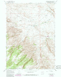
1964 Map of Maneater Creek
USGS Topo · Published 1985About this map
Medicine Bow National Forest occupies the southern portion of this landscape in Converse County, where the terrain rises sharply into Manning Ridge and the drainages of the West Fork and Mill Creek. The map documents a working ranching environment in the mid-1960s, evidenced by a network of isolated homesteads and water management features like Nagle Ditch No 3 and the Flowing Well. Life in this part of Wyoming was centered around named landholdings such as the Rauber Ranch, Middleton Ranch, and the Rogers Place, served by the Wagon Hound Sch. Transportation is characterized by established routes like the Upper Wagon Hound Road and numerous unnamed jeep trails that navigate the high country around Maneater Creek and La Bonte Creek. This survey provides a clear view of the rural infrastructure and land use patterns common to the high plains and foothills prior to modern development.
Find a feature on this map
38 named features on this map. Tap any name to fly to it.
Don’t see what you’re looking for? This feature index may not catch every label — zoom into the map to look around manually.
Map Details
Editions of this 1964 Maneater Creek Map
2 editions found
Other maps of this area

1943 · Esterbrook
USGS Topo · 1:62,500

1945 · Esterbrook
USGS Topo · 1:62,500

1949 · Poison Lake
USGS Topo · 1:24,000

1949 · Chalk Buttes
USGS Topo · 1:24,000

1950 · Poison Lake
USGS Topo · 1:24,000
1950 · Chalk Buttes
USGS Topo · 1:24,000

1954 · Torrington
USGS Topo · 1:250,000

1958 · Torrington
USGS Topo · 1:250,000

1964 · School Section Mountain
USGS Topo · 1:24,000
1964 · Hermit Rock
USGS Topo · 1:24,000