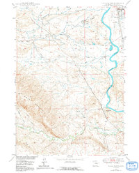
1949 Map of Chalk Buttes
USGS Topo · Published 1991About this map
The Emigrant Wagon Trail cuts a diagonal path through this landscape, marking the enduring legacy of the westward migration routes south of Douglas. This survey, conducted as part of the Missouri River Basin development program, captures the intersection of pioneering history and mid-century topographical mapping. Multiple instances of the Oregon Trail Monument are documented along the route as it traverses the high ground between the North Platte River and the prominent rising mass of Sheep Mountain.
Find a feature on this map
16 named features on this map. Tap any name to fly to it.
Don’t see what you’re looking for? This feature index may not catch every label — zoom into the map to look around manually.
Map Details
Editions of this 1949 Chalk Buttes Map
3 editions found
Other maps of this area

1949 · Orpha
USGS Topo · 1:24,000

1949 · Irvine
USGS Topo · 1:24,000

1949 · Poison Lake
USGS Topo · 1:24,000

1949 · Douglas
USGS Topo · 1:24,000

1949 · Dilts Ranch
USGS Topo · 1:24,000

1949 · Chalk Buttes
USGS Topo · 1:24,000

1949 · Antelope Creek
USGS Topo · 1:24,000

1950 · Poison Lake
USGS Topo · 1:24,000

1950 · Douglas
USGS Topo · 1:24,000

1950 · Orpha
USGS Topo · 1:24,000