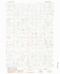
1984 Map of Bill SE
USGS Topo · Published 1984About this map
Lightning Creek and its tributary Little Lightning Creek define the drainage patterns of this high plains landscape in Converse County. The terrain is marked by a network of intermittent draws and coulees, including the named Alexander Draw, which channel seasonal water toward the larger creek beds. A significant man-made feature in this arid environment is the Fiddleback Reservoir, appearing as a vital water source for local ranching operations. The presence of the label Box suggests a specific localized geographic or ranch-related landmark in the northern reaches of the sheet. Surveyed in the late 1970s and finalized in the early 1980s, this document captures a sparsely populated region of the northern frontier during a period of refined topographic mapping, where land management and water rights were paramount to the local economy.
Find a feature on this map
7 named features on this map. Tap any name to fly to it.
Don’t see what you’re looking for? This feature index may not catch every label — zoom into the map to look around manually.
Map Details
Editions of this 1984 Bill SE Map
This is the sole edition of this map. No revisions or reprints were ever made.
Other maps of this area

1949 · Sundquist Ranch
USGS Topo · 1:24,000

1949 · Clausen Ranch
USGS Topo · 1:24,000

1950 · Clausen Ranch
USGS Topo · 1:24,000
1950 · Sundquist Ranch
USGS Topo · 1:24,000

1954 · Torrington
USGS Topo · 1:250,000

1955 · Newcastle
USGS Topo · 1:250,000

1958 · Torrington
USGS Topo · 1:250,000

1958 · Newcastle
USGS Topo · 1:250,000

1959 · Bill
USGS Topo · 1:62,500

1970 · Bill 4 NW
USGS Topo · 1:24,000