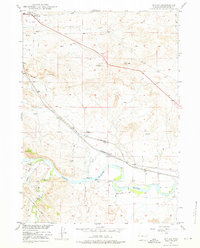
1949 Map of Irvine
USGS Topo · Published 1976About this map
Douglas serves as the focal point for this section of Converse County, marking a vital junction where the Chicago and Northwestern and the Burlington and Quincy railroads parallel the North Platte River. The landscape is defined by the river’s winding course and the essential water management infrastructure that supported local ranching and transit in the late 1940s, including numerous instances of ditch systems and strategically placed windmills.
Find a feature on this map
23 named features on this map. Tap any name to fly to it.
Don’t see what you’re looking for? This feature index may not catch every label — zoom into the map to look around manually.
Map Details
Editions of this 1949 Irvine Map
2 editions found
Other maps of this area

1949 · Irvine
USGS Topo · 1:24,000

1949 · Poison Lake
USGS Topo · 1:24,000

1949 · Cedar Hill
USGS Topo · 1:24,000

1949 · Douglas
USGS Topo · 1:24,000

1949 · Dilts Ranch
USGS Topo · 1:24,000

1949 · Chalk Buttes
USGS Topo · 1:24,000

1949 · Orin
USGS Topo · 1:24,000

1949 · Antelope Creek
USGS Topo · 1:24,000

1950 · Poison Lake
USGS Topo · 1:24,000

1950 · Douglas
USGS Topo · 1:24,000