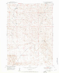
1950 Map of Hylton Ranch
USGS Topo · Published 1950About this map
Hylton Ranch serves as a central waypoint in this 1950 landscape, which documents the remote ranching and energy-extraction territory of Converse County. The map captures a transitional moment for local industry, specifically identifying a Coal Mine (Inactive) alongside an active Coal Mine. This juxtaposition provides a clear record of changing resource use in the Missouri River Basin during the mid-century period. Transport in the region is defined by the Glenrock-Ross Road, which cuts through the high desert terrain. Water management, critical for both livestock and mining operations, is marked by features like the Sand Creek Reservoir, Sand Creek, and the seasonally variable Dry Lake. Elevations rise toward the descriptive landmark Top of the World, while numerous windmills scattered across the quadrangle indicate the infrastructure necessary to sustain the ranching economy in this arid environment.
Find a feature on this map
10 named features on this map. Tap any name to fly to it.
Don’t see what you’re looking for? This feature index may not catch every label — zoom into the map to look around manually.
Map Details
Editions of this 1950 Hylton Ranch Map
2 editions found
Other maps of this area

1949 · Careyhurst
USGS Topo · 1:24,000

1949 · Parkerton
USGS Topo · 1:24,000

1949 · Glenrock
USGS Topo · 1:24,000

1949 · Leuenberger Ranch
USGS Topo · 1:24,000

1949 · Glenrock NW
USGS Topo · 1:24,000

1949 · Hylton Ranch
USGS Topo · 1:24,000

1950 · Careyhurst
USGS Topo · 1:24,000

1950 · Leuenberger Ranch
USGS Topo · 1:24,000

1950 · Parkerton
USGS Topo · 1:24,000

1950 · Glenrock NW
USGS Topo · 1:24,000