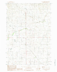
1984 Map of Dugout Creek South
USGS Topo · Published 1984About this map
Dry Fork Cheyenne River meanders across this High Plains landscape, marking a critical drainage point in Converse County. This 1984 provisional edition highlights a sparse, water-defined geography where ephemeral systems like Dugout Creek and the aptly named Calamity Gulch dictate the layout of the land. Surveyed in the late 1970s, the map provides a look at the township and range boundaries of T 39 N and T 38 N during a period of modern land management. The lack of concentrated settlements underscores the vast, open character of the Wyoming ranching or energy-producing backcountry during this era, focusing instead on the subtle topography and the winding course of the river fork.
Find a feature on this map
4 named features on this map. Tap any name to fly to it.
Don’t see what you’re looking for? This feature index may not catch every label — zoom into the map to look around manually.
Map Details
Editions of this 1984 Dugout Creek South Map
This is the sole edition of this map. No revisions or reprints were ever made.
Other maps of this area

1955 · Newcastle
USGS Topo · 1:250,000

1958 · Newcastle
USGS Topo · 1:250,000

1959 · Bill
USGS Topo · 1:62,500

1959 · Betty Reservoir
USGS Topo · 1:62,500

1970 · Bill 4 NW
USGS Topo · 1:24,000

1971 · Coal Bank Draw
USGS Topo · 1:24,000

1971 · Tin Can Lake
USGS Topo · 1:24,000

1979 · Bill
USGS Topo · 1:100,000
1984 · Dugout Creek North
USGS Topo · 1:24,000
1984 · Patsy Draw
USGS Topo · 1:24,000