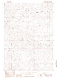
1984 Map of Holdup Hollow
USGS Topo · Published 1984About this map
Birkner Hill and the surrounding high country of the Turner Divide define this central Wyoming landscape in the mid-1980s. The region is characterized by a network of drainage draws and ridges, including the appropriately named Blizzard Heights and the evocative Holdup Hollow. Water management in this arid terrain is evidenced by the presence of the Silver Spoon Reservoir and South Fork Reservoir, alongside natural sources like White Rock Spring and Lake Spring. Settlement patterns are sparse, represented primarily by isolated ranching operations such as Hylton Ranch and Leuenberger Ranch. The map traces the intricate paths of Sage Creek and Potts Creek, illustrating how land use is dictated by the availability of water and the orientation of the high Divide.
Find a feature on this map
30 named features on this map. Tap any name to fly to it.
Don’t see what you’re looking for? This feature index may not catch every label — zoom into the map to look around manually.
Map Details
Editions of this 1984 Holdup Hollow Map
This is the sole edition of this map. No revisions or reprints were ever made.
Other maps of this area

1949 · Gilbert Lake
USGS Topo · 1:24,000

1949 · Leuenberger Ranch
USGS Topo · 1:24,000

1949 · Hylton Ranch
USGS Topo · 1:24,000

1950 · Gilbert Lake
USGS Topo · 1:24,000

1950 · Leuenberger Ranch
USGS Topo · 1:24,000
1950 · Hylton Ranch
USGS Topo · 1:24,000

1954 · Torrington
USGS Topo · 1:250,000

1955 · Newcastle
USGS Topo · 1:250,000

1958 · Torrington
USGS Topo · 1:250,000

1958 · Newcastle
USGS Topo · 1:250,000