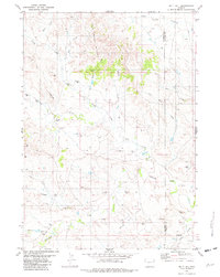
1981 Map of Split Hill
USGS Topo · Published 1982About this map
Kaye Oil Field dominates the southern landscape of this 1980s Wyoming survey, marking a period of active energy development across the Converse and Niobrara County line. The terrain is defined by a dense network of intermittent drainages including Lightning Creek, Little Cow Creek, and Piney Creek, which carve through the high plains toward the distinctive elevations of Cow Creek Buttes.
Find a feature on this map
21 named features on this map. Tap any name to fly to it.
Don’t see what you’re looking for? This feature index may not catch every label — zoom into the map to look around manually.
Map Details
Editions of this 1981 Split Hill Map
This is the sole edition of this map. No revisions or reprints were ever made.
Other maps of this area

1955 · Newcastle
USGS Topo · 1:250,000

1958 · Newcastle
USGS Topo · 1:250,000

1970 · Bill 4 SE
USGS Topo · 1:24,000

1970 · Bill 4 NE
USGS Topo · 1:24,000

1971 · Esau Spring
USGS Topo · 1:24,000

1979 · Bill
USGS Topo · 1:100,000

1981 · Calf Draw
USGS Topo · 1:24,000

1981 · Mercer Draw
USGS Topo · 1:24,000

1981 · Pinnacle Rocks
USGS Topo · 1:24,000
1981 · Split Hill SW
USGS Topo · 1:24,000