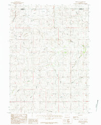
1984 Map of Ross Flat
USGS Topo · Published 1984About this map
Ross Flat defines the high plains landscape of the Powder River Basin during the mid-1980s, straddling the border between Campbell and Converse counties. This topographical survey reveals an intricate drainage system etched into the plateau, where seasonal waterways like McNaughton Draw and Ninemile Creek dictate the contours of the land. The presence of a Prospect near the center of the sheet highlights the industrial potential and resource exploration that has long characterized this portion of Wyoming.
Find a feature on this map
15 named features on this map. Tap any name to fly to it.
Don’t see what you’re looking for? This feature index may not catch every label — zoom into the map to look around manually.
Map Details
Editions of this 1984 Ross Flat Map
This is the sole edition of this map. No revisions or reprints were ever made.
Other maps of this area

1954 · Artesian Draw
USGS Topo · 1:24,000

1954 · Pine Tree
USGS Topo · 1:24,000

1955 · Newcastle
USGS Topo · 1:250,000

1958 · Newcastle
USGS Topo · 1:250,000

1959 · Coal Draw
USGS Topo · 1:62,500

1960 · Ross
USGS Topo · 1:62,500

1960 · Turnercrest
USGS Topo · 1:62,500

1974 · Reno Junction
USGS Topo · 1:100,000

1979 · Bill
USGS Topo · 1:100,000
1984 · Marsh Draw
USGS Topo · 1:24,000