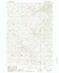
1984 Map of Gumbo Hill
USGS Topo · Published 1984About this map
Gumbo Hill rises above a high plains landscape defined by an intricate network of intermittent drainages and small-scale water management in Converse County. The geography is dominated by the complex branching of the Dry Fork Cheyenne River, including its Middle Fork and South Fork. Ranching infrastructure is evident through numerous named catchments such as 21 Mile Reservoir, Eberspecher Reservoir, and Manser Reservoir, which dot the draws and gulches.
Find a feature on this map
24 named features on this map. Tap any name to fly to it.
Don’t see what you’re looking for? This feature index may not catch every label — zoom into the map to look around manually.
Map Details
Editions of this 1984 Gumbo Hill Map
This is the sole edition of this map. No revisions or reprints were ever made.
Other maps of this area

1949 · Campbell Hill
USGS Topo · 1:24,000

1949 · Glenrock NW
USGS Topo · 1:24,000

1949 · Hylton Ranch
USGS Topo · 1:24,000

1950 · Campbell Hill
USGS Topo · 1:24,000

1950 · Glenrock NW
USGS Topo · 1:24,000
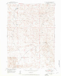
1950 · Hylton Ranch
USGS Topo · 1:24,000

1954 · Torrington
USGS Topo · 1:250,000

1955 · Newcastle
USGS Topo · 1:250,000

1955 · Arminto
USGS Topo · 1:250,000

1955 · Casper
USGS Topo · 1:250,000