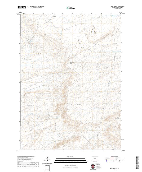
2021 Map of Boot Heel SE
USGS Topo · Published 2021About this map
Fetterman Rd cuts through this high-plains landscape in northern Albany County, tracing a route through a series of significant drainage basins and draws. The terrain is defined by its water management features, notably the Twentytwo Mile Reservoir and Twentymile Reservoir, which collect runoff from the surrounding draws. These features, along with Twentytwo Mile Draw and Twentymile Draw, illustrate the vital importance of seasonal water catchments in this arid ranching country.
Find a feature on this map
14 named features on this map. Tap any name to fly to it.
Don’t see what you’re looking for? This feature index may not catch every label — zoom into the map to look around manually.
Map Details
Editions of this 2021 Boot Heel SE Map
This is the sole edition of this map. No revisions or reprints were ever made.
Other maps of this area

1954 · Torrington
USGS Topo · 1:250,000

1954 · Cheyenne
USGS Topo · 1:250,000

1955 · Pine Tree Ridge
USGS Topo · 1:24,000

1955 · Sevenmile Spring
USGS Topo · 1:24,000

1955 · Ayres Spring
USGS Topo · 1:24,000

1958 · Cheyenne
USGS Topo · 1:250,000

1958 · Torrington
USGS Topo · 1:250,000

1968 · Cottonwood Creek
USGS Topo · 1:24,000
1968 · Boot Heel
USGS Topo · 1:24,000
1968 · Greasewood Knoll
USGS Topo · 1:24,000