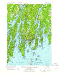
1957 Map of Boothbay
USGS Topo · Published 1961About this map
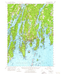
Fort Edgecomb stands at the northern narrows of the Sheepscot River, overlooking a labyrinth of tidal rivers and jagged peninsulas that define the Midcoast region in the late 1950s. This survey details the complex maritime geography between Westport Island and Pemaquid Neck, where fishing villages like Boothbay Harbor, New Harbor, and South Bristol anchor the local economy. The landscape is dotted with historical markers of early Maine settlement, including the Old Walpole Meeting House and family-named sites like Grover Cem. While the Maine Central RR skirts the northern edge, the interior is shaped by the winding courses of the Damariscotta River and the Back River. From the offshore Damariscove Island with its U S Coast Guard Sta Damiscove to the summer retreats at Ocean Point, the map captures a coastal society balancing its deep colonial roots with growing mid-century recreation.
Find a feature on this map
103 named features on this map. Tap any name to fly to it.
Don’t see what you’re looking for? This feature index may not catch every label — zoom into the map to look around manually.
Map Details
Editions of this 1957 Boothbay Map
7 editions found
Other maps of this area

1892 · Gardiner
USGS Topo · 1:62,500

1893 · Small Point
USGS Topo · 1:62,500

1893 · Wiscasset
USGS Topo · 1:62,500

1893 · Boothbay
USGS Topo · 1:62,500

1894 · Bath
USGS Topo · 1:62,500

1904 · Monhegan
USGS Topo · 1:62,500

1906 · Monhegan
USGS Topo · 1:62,500

1913 · Waldoboro
USGS Topo · 1:48,000

1915 · Waldoboro
USGS Topo · 1:62,500

1919 · Small Point
USGS Topo · 1:62,500