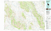
1989 Map of Borah Peak
USGS Topo · Published 1989About this map
Borah Peak and the high summits of the Lost River Range dominate this 1980s landscape, where deep glacial valleys separate massive mountain blocks. The map reveals a high-altitude ranching and mining environment characterized by broad alluvial fans like Barton Flats and Sunny Bar. Small, isolated settlements such as Gilmore and Nicholia anchor the edges of the Birch Creek Valley, while the Wilbert Mine and Sentinel Mine suggest the region's enduring connection to mineral extraction.
Find a feature on this map
57 named features on this map. Tap any name to fly to it.
Don’t see what you’re looking for? This feature index may not catch every label — zoom into the map to look around manually.
Map Details
Editions of this 1989 Borah Peak Map
This is the sole edition of this map. No revisions or reprints were ever made.
Other maps of this area

1895 · Hailey
USGS Topo · 1:125,000

1897 · Hailey
USGS Topo · 1:125,000

1929 · Bayhorse
USGS Topo · 1:125,000

1935 · MacKay
USGS Topo · 1:96,000

1935 · Borah Peak
USGS Topo · 1:125,000

1938 · Borah Peak
USGS Topo · 1:125,000

1940 · Mackay
USGS Topo · 1:62,500

1955 · Dubois
USGS Topo · 1:250,000

1955 · Idaho Falls
USGS Topo · 1:250,000

1955 · Hailey
USGS Topo · 1:250,000