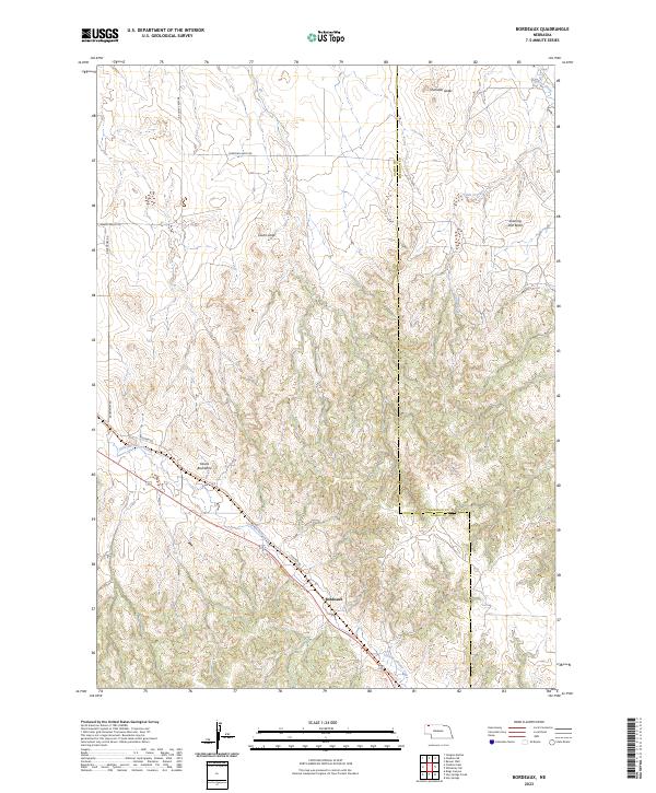
2023 Map of Bordeaux
USGS Topo · Published 2023About this map
Bordeaux sits along the winding course of Little Bordeaux Creek in this modern topographic view of the High Plains transition. The landscape is defined by its dramatic geologic formations, including the distinctive ridge of Devils Backbone and prominent high points such as Evening Star Butte and Lovers Leap. These features provide a clear sense of the vertical relief that characterizes the border of Dawes and Sheridan counties.
Find a feature on this map
20 named features on this map. Tap any name to fly to it.
Don’t see what you’re looking for? This feature index may not catch every label — zoom into the map to look around manually.
Map Details
Editions of this 2023 Bordeaux Map
This is the sole edition of this map. No revisions or reprints were ever made.
Other maps of this area

1955 · Alliance
USGS Topo · 1:250,000

1957 · Alliance
USGS Topo · 1:250,000

1958 · Alliance
USGS Topo · 1:250,000

1966 · Hay Springs
USGS Topo · 1:24,000

1966 · Chadron 3 NE
USGS Topo · 1:24,000

1969 · Beaver Wall
USGS Topo · 1:24,000

1969 · Chadron NE
USGS Topo · 1:24,000

1969 · Bordeaux
USGS Topo · 1:24,000
1969 · Whiteclay SW
USGS Topo · 1:24,000

1970 · Chadron 3 NW
USGS Topo · 1:24,000