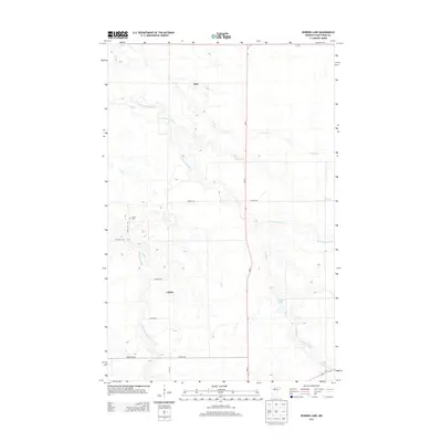
2013 Map of Borden Lake
USGS Topo · Published 2013About this map
Langor and Inez serve as the primary points of reference in this Beltrami County landscape, where the local economy and settlement patterns are defined by a complex network of waterways. The Blackduck River and the S Cormorant River wind through the terrain, joined by smaller tributaries like Perry Cr, Fish Cr, and Detling Cr. This 2013 survey illustrates the modern road grid, including MN-72 and Co HWY-32, which connects these rural communities to the surrounding region. Genealogists may find particular value in the location of the Langor Cem, situated along Town Hall Rd north of the main settlement. The presence of Borden Lake and the meandering Spring Creek in the southeastern quadrant highlights the area's natural drainage and characteristic Minnesota wetland topography.
Find a feature on this map
22 named features on this map. Tap any name to fly to it.
Don’t see what you’re looking for? This feature index may not catch every label — zoom into the map to look around manually.
Map Details
Editions of this 2013 Borden Lake Map
This is the sole edition of this map. No revisions or reprints were ever made.
Other maps of this area

1919 · Rosy
USGS Topo · 1:62,500

1919 · Quiring
USGS Topo · 1:62,500

1919 · Bridgie
USGS Topo · 1:62,500

1924 · Bridgie
USGS Topo · 1:62,500

1954 · Bemidji
USGS Topo · 1:250,000

1957 · Bemidji
USGS Topo · 1:250,000

1958 · Bemidji
USGS Topo · 1:250,000

1971 · Funkley
USGS Topo · 1:24,000

1971 · Decker Lake
USGS Topo · 1:24,000
1971 · Kelliher
USGS Topo · 1:24,000