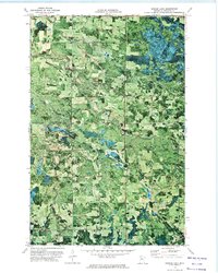
1972 Map of Borden Lake
USGS Topo · Published 1974About this map
Cormorant Ch and the nearby Township Cem serve as cultural anchors in this northern Minnesota landscape, where drainage patterns define the boundaries of local life. The area is characterized by the winding path of Cormorant Creek as it feeds into the South Cormorant River, weaving through the townships of Gorman, Shooks, and Langor. Small rural settlements like Inez and Langor appear as clusters of activity along a road network that traverses dense woodlands and wetlands. The hydrography is particularly detailed, showing the Blackduck River and the secluded Borden Lake in the southern portion of the quadrangle. An orthophotomap base provides a unique visual layer, capturing the exact timber and meadow patterns that surrounded these isolated Beltrami County communities in the early 1970s.
Find a feature on this map
17 named features on this map. Tap any name to fly to it.
Don’t see what you’re looking for? This feature index may not catch every label — zoom into the map to look around manually.
Map Details
Editions of this 1972 Borden Lake Map
This is the sole edition of this map. No revisions or reprints were ever made.
Other maps of this area

1919 · Rosy
USGS Topo · 1:62,500

1919 · Quiring
USGS Topo · 1:62,500

1919 · Bridgie
USGS Topo · 1:62,500

1924 · Bridgie
USGS Topo · 1:62,500

1954 · Bemidji
USGS Topo · 1:250,000

1957 · Bemidji
USGS Topo · 1:250,000

1958 · Bemidji
USGS Topo · 1:250,000

1971 · Funkley
USGS Topo · 1:24,000

1971 · Decker Lake
USGS Topo · 1:24,000
1971 · Kelliher
USGS Topo · 1:24,000