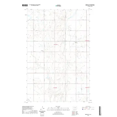
2020 Map of Bordulac NE
USGS Topo · Published 2020About this map
James River meanders through this portion of Foster County, carving a distinct valley through the rolling prairie landscape. This region of North Dakota is defined by its rural character and the persistent presence of agricultural heritage. Landmarks of local faith and family history are prominently marked, including the James River Church and its adjacent James River Church Lutheran Cem. Further west, the Brethren Cem serves as another focal point for genealogical research in this sparsely populated area. The water system is a central feature of the terrain, with Kelly Cr feeding into the Niccum Reservoir before reaching the larger river. This map shows a grid of section lines and rural roads, such as Main St E and 80th Ave NE, which organize the homesteads and fields across the townships of T146N and T145N.
Find a feature on this map
31 named features on this map. Tap any name to fly to it.
Don’t see what you’re looking for? This feature index may not catch every label — zoom into the map to look around manually.
Map Details
Editions of this 2020 Bordulac NE Map
This is the sole edition of this map. No revisions or reprints were ever made.
Other maps of this area

1900 · Pingree
USGS Topo · 1:125,000

1944 · Brantford
USGS Topo · 1:62,500

1946 · Brantford
USGS Topo · 1:62,500

1949 · Grace City
USGS Topo · 1:24,000

1950 · Grace City
USGS Topo · 1:24,000

1950 · Brantford
USGS Topo · 1:24,000

1951 · Bordulac NE
USGS Topo · 1:24,000

1951 · Arrowwood Lake
USGS Topo · 1:24,000

1951 · Kensal
USGS Topo · 1:24,000

1951 · Kensal NW
USGS Topo · 1:24,000