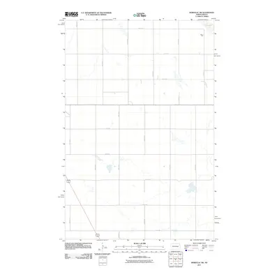
2011 Map of Bordulac SW
USGS Topo · Published 2011About this map
Millers Spur stands near the northeastern corner of this Stutsman County landscape, a small junction marking a former rail or transport point just south of the expansive Dry Lake depression. The terrain is defined by a rigorous sectional grid of section roads, with routes like 3rd St SE and 11th St SE creating a geometric pattern across the prairie. This 2011 survey by the U.S. Geological Survey shows a sparsely settled agricultural region where water features are ephemeral or seasonal, characteristic of the North Dakota pothole region. The alignment of north-south avenues, from 71st Ave SE to 78th Ave SE, highlights the persistence of the Public Land Survey System in organizing the rural infrastructure and modern road network of the central plains.
Find a feature on this map
18 named features on this map. Tap any name to fly to it.
Don’t see what you’re looking for? This feature index may not catch every label — zoom into the map to look around manually.
Map Details
Editions of this 2011 Bordulac SW Map
This is the sole edition of this map. No revisions or reprints were ever made.
Other maps of this area

1900 · Pingree
USGS Topo · 1:125,000

1900 · Pingree
USGS Topo · 1:62,500

1948 · Carrington
USGS Topo · 1:62,500

1950 · Carrington East
USGS Topo · 1:24,000

1950 · Melville
USGS Topo · 1:24,000

1951 · Bordulac NE
USGS Topo · 1:24,000

1951 · Arrowwood Lake
USGS Topo · 1:24,000

1951 · Pingree
USGS Topo · 1:24,000

1951 · Bordulac SW
USGS Topo · 1:24,000
1951 · Bordulac
USGS Topo · 1:24,000