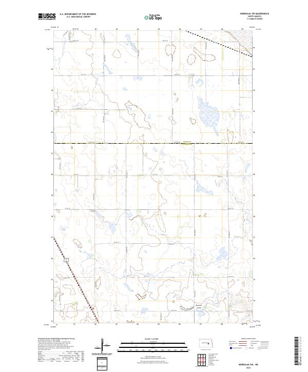
2024 Map of Bordulac SW
USGS Topo · Published 2024About this map
Stutsman County Waterfowl Production Area dominates the central landscape of this rural prairie survey, illustrating the critical role of conservation lands in the North Dakota pothole region. The terrain is defined by an intricate network of wetlands and small water bodies typical of the glaciated plains, with Bennetts Coulee carving through the southern sections. This area represents a quiet, agricultural corner where the boundary between Foster Co and Stutsman Co follows the straight line of 6th St SE. The map reveals a strictly organized grid of section lines and gravel roads, such as 71st Ave SE and 11th St SE, which have dictated the pattern of land use and property ownership for generations. It is a landscape shaped by both the natural hydrology of the plains and the orderly geometry of the Public Land Survey System.
Find a feature on this map
24 named features on this map. Tap any name to fly to it.
Don’t see what you’re looking for? This feature index may not catch every label — zoom into the map to look around manually.
Map Details
Editions of this 2024 Bordulac SW Map
This is the sole edition of this map. No revisions or reprints were ever made.
Other maps of this area

1900 · Pingree
USGS Topo · 1:125,000

1900 · Pingree
USGS Topo · 1:62,500

1948 · Carrington
USGS Topo · 1:62,500

1950 · Carrington East
USGS Topo · 1:24,000

1950 · Melville
USGS Topo · 1:24,000

1951 · Bordulac NE
USGS Topo · 1:24,000

1951 · Arrowwood Lake
USGS Topo · 1:24,000

1951 · Pingree
USGS Topo · 1:24,000

1951 · Bordulac SW
USGS Topo · 1:24,000
1951 · Bordulac
USGS Topo · 1:24,000