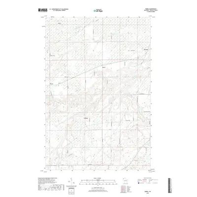
2018 Map of Borea
USGS Topo · Published 2018About this map
Borea sits at the heart of this Douglas County landscape, where the meandering drainage of the Nemadji River and Black River systems creates a complex network of ravines and waterways. The area is defined by small, dispersed settlements like Dedham, Boylston, and Dewey, connected by a grid of rural routes and family-named roads such as Mertes Rd and Graves Rd. A notable topographical shift occurs in the southeast, where the terrain breaks at Rocky Gorge and the waters of the Black River reach Little Manitou Falls. This map captures the region's character as a transition between upland forests and the river valleys that feed toward Lake Superior. Local history and geography are preserved through specific landmarks like Iron Dale Rd, suggesting the area's industrial or mining legacy, alongside numerous named tributaries including Balsam Cr and Little Pokegama River.
Find a feature on this map
51 named features on this map. Tap any name to fly to it.
Don’t see what you’re looking for? This feature index may not catch every label — zoom into the map to look around manually.
Map Details
Editions of this 2018 Borea Map
This is the sole edition of this map. No revisions or reprints were ever made.
Other maps of this area

1915 · Superior
USGS Topo · 1:48,000

1917 · Superior
USGS Topo · 1:62,500

1949 · Holyoke
USGS Topo · 1:48,000

1949 · Patzau
USGS Topo · 1:48,000

1953 · Duluth
USGS Topo · 1:250,000

1954 · West Duluth
USGS Topo · 1:24,000

1954 · Borea
USGS Topo · 1:24,000

1954 · Foxboro
USGS Topo · 1:24,000

1954 · Sunnyside
USGS Topo · 1:24,000
1954 · Superior
USGS Topo · 1:24,000