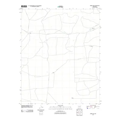
2010 Map of Borica SW
USGS Topo · Published 2010About this map
Salado Creek cuts through this high plains region of Guadalupe County, serving as a primary geographic landmark for the ranching operations that define the area. The landscape is characterized by its wide-open spaces and essential water infrastructure, including the North Salado Windmill and the evocative High Lonesome Windmill. Ranching history is anchored by the Good Ranch in the west and Overton Ranch situated further south along the county road network. The grid of roads, including County Rd-1-35 and County Rd-1-37, facilitates movement between these remote outposts and the scattered Gillum Windmill, reflecting the specialized requirements of livestock management in the arid New Mexico climate during the early twenty-first century.
Find a feature on this map
13 named features on this map. Tap any name to fly to it.
Don’t see what you’re looking for? This feature index may not catch every label — zoom into the map to look around manually.
Map Details
Editions of this 2010 Borica SW Map
This is the sole edition of this map. No revisions or reprints were ever made.
Other maps of this area

1954 · Fort Sumner
USGS Topo · 1:250,000

1958 · Fort Sumner
USGS Topo · 1:250,000

1966 · Ojo Negro Creek
USGS Topo · 1:24,000

1966 · Borica SW
USGS Topo · 1:24,000

1966 · Cooper Ranch
USGS Topo · 1:24,000

1966 · Yeso
USGS Topo · 1:24,000

1966 · Yeso NW
USGS Topo · 1:24,000

1966 · Borica
USGS Topo · 1:24,000

1978 · El Morro Ranch SE
USGS Topo · 1:24,000

1978 · Laguna De Los Terreros
USGS Topo · 1:24,000