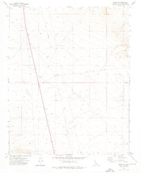
1973 Map of Boron NE
USGS Topo · Published 1976About this map
The Fremont (Site) marks the center of this 1970s desert landscape, situated near the intersection of several historic transit routes. The presence of an Old Railroad Grade running roughly north-to-south suggests a period when industrial transport supported local activity, though by this era the map identifies only isolated Prospects and a Prospect scattered among the contours.
Find a feature on this map
11 named features on this map. Tap any name to fly to it.
Don’t see what you’re looking for? This feature index may not catch every label — zoom into the map to look around manually.
Map Details
Editions of this 1973 Boron NE Map
3 editions found
Other maps of this area

1903 · Randsburg
USGS Topo · 1:62,500

1911 · Randsburg
USGS Topo · 1:62,500

1912 · Randsburg
USGS Topo · 1:62,500

1915 · Searles Lake
USGS Topo · 1:250,000

1947 · Johannesburg SE
USGS Topo · 1:25,000

1947 · Johannesburg SW
USGS Topo · 1:24,000

1947 · Trona
USGS Topo · 1:250,000

1948 · Trona
USGS Topo · 1:250,000

1953 · Trona
USGS Topo · 1:250,000
1954 · Boron
USGS Topo · 1:62,500