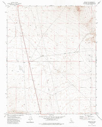
1973 Map of Boron NE
USGS Topo · Published 1987About this map
The high desert terrain of northeastern San Bernardino County is defined here by the remnants of early resource extraction and transit. The Fremont (Site) serves as a focal point for the landscape, situated near a complex network of ephemeral infrastructure including a Dry Well and an isolated Corral. The presence of several Prospects and an individual Prospect across the northern sections suggests a history of mineral exploration in the shadow of the mountains, while the Old Railroad Grade and Fremont Peak Road indicate the primary corridors that once connected these remote camps to the wider region.
Find a feature on this map
9 named features on this map. Tap any name to fly to it.
Don’t see what you’re looking for? This feature index may not catch every label — zoom into the map to look around manually.
Map Details
Editions of this 1973 Boron NE Map
3 editions found
Other maps of this area

1903 · Randsburg
USGS Topo · 1:62,500

1911 · Randsburg
USGS Topo · 1:62,500

1912 · Randsburg
USGS Topo · 1:62,500

1915 · Searles Lake
USGS Topo · 1:250,000

1947 · Johannesburg SE
USGS Topo · 1:25,000

1947 · Johannesburg SW
USGS Topo · 1:24,000

1947 · Trona
USGS Topo · 1:250,000

1948 · Trona
USGS Topo · 1:250,000

1953 · Trona
USGS Topo · 1:250,000
1954 · Boron
USGS Topo · 1:62,500