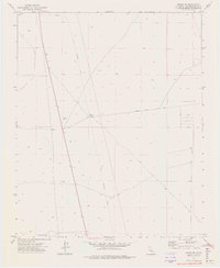
1973 Map of Boron NE
USGS Topo · Published 1976About this map
The Fremont (Site) marks a point of historical interest in this high desert landscape, representing a location of former activity north of the modern mining hubs. The terrain is defined by the infrastructure of previous eras, most notably the long, diagonal path of an Old Railroad Grade that cuts through the desert flats. This corridor once facilitated transport through the region, connecting remote outposts and potential mineral claims. Evidence of exploration and early land use is visible in the scattered Prospects and a lonely Corral situated near the intersection of various desert routes. While much of the area remains open, the influence of governmental land management is seen in the proximity of the U S Military Res, which borders the southern and western portions of the quadrangle. Surface water is essentially absent, with only the namesake Dry Well indicating the challenges of the arid environment.
Find a feature on this map
10 named features on this map. Tap any name to fly to it.
Don’t see what you’re looking for? This feature index may not catch every label — zoom into the map to look around manually.
Map Details
Editions of this 1973 Boron NE Map
3 editions found
Other maps of this area

1903 · Randsburg
USGS Topo · 1:62,500

1911 · Randsburg
USGS Topo · 1:62,500

1912 · Randsburg
USGS Topo · 1:62,500

1915 · Searles Lake
USGS Topo · 1:250,000

1947 · Johannesburg SE
USGS Topo · 1:25,000

1947 · Johannesburg SW
USGS Topo · 1:24,000

1947 · Trona
USGS Topo · 1:250,000

1948 · Trona
USGS Topo · 1:250,000

1953 · Trona
USGS Topo · 1:250,000
1954 · Boron
USGS Topo · 1:62,500